![](/images/other/stat-length.png)
![Excursión Senderismo La Coulonche - UIA LF 28/11/2018 - Photo](https://media.geolcdn.com/t/1900/400/ext.pjpeg?maxdim=2&url=https%3A%2F%2Fstatic1.geolcdn.com%2Fsiteimages%2Fupload%2Ffiles%2F1553511878bg_sport_marche.png)
UIA LF 28/11/2018
toporient
Usuario
![Longitud](/images/other/stat-length.png)
Longitud
7,5 km
![Altitud máxima](https://static1.geolcdn.com/siteimages/upload/files/1508320355ic_sort_altitude_max_24dp.png)
Altitud máxima
330 m
![Desnivel positivo](https://static1.geolcdn.com/siteimages/upload/files/1508320355ic_sort_den_pos_24dp.png)
Desnivel positivo
133 m
![Km-Effort](/images/other/stat-length.png)
Km-Effort
9,3 km
![Altitud mínima](https://static1.geolcdn.com/siteimages/upload/files/1508320355ic_sort_altitude_min_24dp.png)
Altitud mínima
242 m
![Desnivel negativo](https://static1.geolcdn.com/siteimages/upload/files/1508320355ic_sort_den_neg_24dp.png)
Desnivel negativo
130 m
![Boucle](https://static1.geolcdn.com/siteimages/upload/files/16400158638029165_repeat_loop_refresh_sync_direction_icon.png)
Boucle
Sí
Fecha de creación :
2019-01-15 18:35:33.363
Última modificación :
2019-05-01 13:30:04.356
![Senderismo](https://static1.geolcdn.com/sitytour/trail-icons/101.png)
2h00
Dificultad : Fácil
![Escanee este código QR para abrir la excursión en la aplicación SityTrail](https://capi.geolives.com/qq0zvz2zws4bq2lad0pu/sitytour/trails/1068747/qr.png?size=200)
Aplicación GPS de excursión GRATIS
A propósito
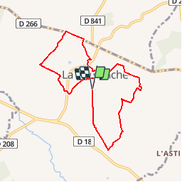
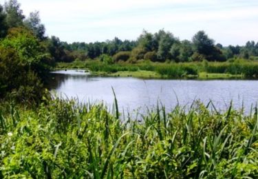
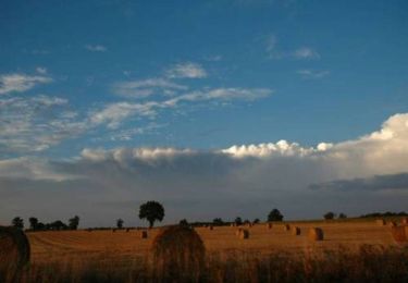
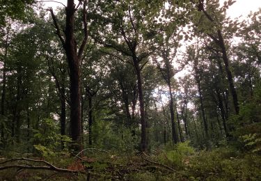
Ruta Senderismo de 7,5 km a descubrir en Normandía, Orne, La Coulonche. Esta ruta ha sido propuesta por toporient.
Descripción
Départ du parking du Stade à l'entrée sud de La Coulonche.
Nota : Le circuit court (4050m) partira du village, passera par Beau Soleil,Le Vivier, La Buatière, la Vieille Verrerie puis retour vers le village après passage en crête.
Localización
País:
France
Región :
Normandía
Departamento/provincia :
Orne
Municipio :
La Coulonche
Localidad:
Unknown
Salida:(Dec)
Salida:(UTM)
687360 ; 5391141 (30U) N.
Comentarios
Excursiones cerca
![Excursión Senderismo La Ferrière-aux-Étangs - Circuit of IRON by Yannick-p14-61 - Photo](https://media.geolcdn.com/t/375/260/ext.jpg?maxdim=2&url=https%3A%2F%2Fmedia.geolcdn.com%2Ff%2Fe9109058-b6fa-4ee9-9d84-e1a504225bdf.jpg)
![Senderismo Senderismo](https://static1.geolcdn.com/sitytour/trail-icons/101.png)
Circuit of IRON by Yannick-p14-61
Senderismo
Medio
(1)
La Ferrière-aux-Étangs,
Normandía,
Orne,
France
![](/images/other/stat-length.png)
13,3 km | 16,5 km-effort
3h 35min
![](https://static1.geolcdn.com/siteimages/upload/files/16400158638029165_repeat_loop_refresh_sync_direction_icon.png)
Sí
![Excursión Senderismo La Coulonche - La coulonche - Photo](https://media.geolcdn.com/t/375/260/ext.jpg?maxdim=2&url=https%3A%2F%2Fmedia.geolcdn.com%2Ff%2F95c3eac8-30e6-4fa2-8846-ef805e476c7d.jpg)
![Senderismo Senderismo](https://static1.geolcdn.com/sitytour/trail-icons/101.png)
La coulonche
Senderismo
Muy fácil
La Coulonche,
Normandía,
Orne,
France
![](/images/other/stat-length.png)
3,7 km | 4,9 km-effort
1h 22min
![](https://static1.geolcdn.com/siteimages/upload/files/16400158638029165_repeat_loop_refresh_sync_direction_icon.png)
Sí
![Excursión Senderismo Les Monts-d'Andaine - La Sauvagerie - Photo](https://media.geolcdn.com/t/375/260/ext.jpg?maxdim=2&url=https%3A%2F%2Fmedia.geolcdn.com%2Ff%2F66a3eb0d-22fc-482f-9682-38ffc518411b.jpg)
![Senderismo Senderismo](https://static1.geolcdn.com/sitytour/trail-icons/101.png)
La Sauvagerie
Senderismo
Muy fácil
Les Monts-d'Andaine,
Normandía,
Orne,
France
![](/images/other/stat-length.png)
9,8 km | 11,6 km-effort
1h 31min
![](https://static1.geolcdn.com/siteimages/upload/files/16400158638029165_repeat_loop_refresh_sync_direction_icon.png)
No
![Excursión Senderismo Bellou-en-Houlme - Le marais du Grand Hazé - Bellou en Houlme - Photo](https://media.geolcdn.com/t/375/260/ext.jpg?maxdim=2&url=https%3A%2F%2Fservices.sitytrail.com%2FGeolivesWS%2FDownloadMedia.ashx%3FTrailID%3D316663%26Media%3D3528_1.jpg)
![Senderismo Senderismo](https://static1.geolcdn.com/sitytour/trail-icons/101.png)
Le marais du Grand Hazé - Bellou en Houlme
Senderismo
Difícil
Bellou-en-Houlme,
Normandía,
Orne,
France
![](/images/other/stat-length.png)
18,2 km | 20 km-effort
4h 30min
![](https://static1.geolcdn.com/siteimages/upload/files/16400158638029165_repeat_loop_refresh_sync_direction_icon.png)
Sí
![Excursión Senderismo La Ferrière-aux-Étangs - La Ferrière - La Ferrière aux Etangs - Photo](https://media.geolcdn.com/t/375/260/ext.jpg?maxdim=2&url=https%3A%2F%2Fservices.sitytrail.com%2FGeolivesWS%2FDownloadMedia.ashx%3FTrailID%3D111661%26Media%3D7899_2.jpg)
![Senderismo Senderismo](https://static1.geolcdn.com/sitytour/trail-icons/101.png)
La Ferrière - La Ferrière aux Etangs
Senderismo
Medio
La Ferrière-aux-Étangs,
Normandía,
Orne,
France
![](/images/other/stat-length.png)
14,3 km | 17,9 km-effort
3h 4min
![](https://static1.geolcdn.com/siteimages/upload/files/16400158638029165_repeat_loop_refresh_sync_direction_icon.png)
Sí
![Excursión Senderismo La Ferrière-aux-Étangs - 1h16 - Photo](https://media.geolcdn.com/t/375/260/ext.jpg?maxdim=2&url=https%3A%2F%2Fmedia.geolcdn.com%2Ff%2F30fe1b0a-da55-41f8-8ede-6b74633fdbd3.jpg)
![Senderismo Senderismo](https://static1.geolcdn.com/sitytour/trail-icons/101.png)
1h16
Senderismo
Medio
La Ferrière-aux-Étangs,
Normandía,
Orne,
France
![](/images/other/stat-length.png)
6,4 km | 8,5 km-effort
1h 16min
![](https://static1.geolcdn.com/siteimages/upload/files/16400158638029165_repeat_loop_refresh_sync_direction_icon.png)
Sí
![Excursión Senderismo La Ferrière-aux-Étangs - La Feriere aux etant - Photo](https://media.geolcdn.com/t/375/260/ext.jpg?maxdim=2&url=https%3A%2F%2Fmedia.geolcdn.com%2Ff%2Ff76f6a14-4f12-4d3c-ba5b-00c3b8cd2d26.jpg)
![Senderismo Senderismo](https://static1.geolcdn.com/sitytour/trail-icons/101.png)
La Feriere aux etant
Senderismo
Muy fácil
La Ferrière-aux-Étangs,
Normandía,
Orne,
France
![](/images/other/stat-length.png)
1,2 km | 1,3 km-effort
36min
![](https://static1.geolcdn.com/siteimages/upload/files/16400158638029165_repeat_loop_refresh_sync_direction_icon.png)
Sí
![Excursión Senderismo La Coulonche - ballade nois de dieufit - Photo](https://media.geolcdn.com/t/375/260/ext.jpg?maxdim=2&url=https%3A%2F%2Fstatic1.geolcdn.com%2Fsiteimages%2Fupload%2Ffiles%2F1553511878bg_sport_marche.png)
![Senderismo Senderismo](https://static1.geolcdn.com/sitytour/trail-icons/101.png)
ballade nois de dieufit
Senderismo
Fácil
La Coulonche,
Normandía,
Orne,
France
![](/images/other/stat-length.png)
5,7 km | 6,8 km-effort
1h 59min
![](https://static1.geolcdn.com/siteimages/upload/files/16400158638029165_repeat_loop_refresh_sync_direction_icon.png)
Sí
![Excursión Senderismo Les Monts-d'Andaine - La Sauvagère - Photo](https://media.geolcdn.com/t/375/260/ext.jpg?maxdim=2&url=https%3A%2F%2Fstatic1.geolcdn.com%2Fsiteimages%2Fupload%2Ffiles%2F1553511878bg_sport_marche.png)
![Senderismo Senderismo](https://static1.geolcdn.com/sitytour/trail-icons/101.png)
La Sauvagère
Senderismo
Medio
Les Monts-d'Andaine,
Normandía,
Orne,
France
![](/images/other/stat-length.png)
9 km | 11 km-effort
2h 30min
![](https://static1.geolcdn.com/siteimages/upload/files/16400158638029165_repeat_loop_refresh_sync_direction_icon.png)
Sí